Maps
 This page is about OBEY's official maps. For maps created by the community, see Community Maps
OBEY currently has 5 official maps for its one gamemode.
Contents
zoneOne
- Map creator: Daniel Dez
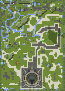
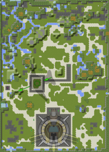
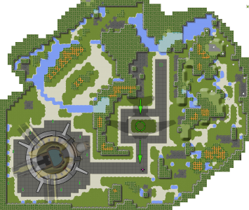
ZoneOne was the first map ever created. It features a Drop Zone that is fairly close to the Feed Box, but has plenty of water nearby to hide in and is close to the right wall which has offsets that provide cover. There is a very densely-covered area down mid-west and north-western sections of the map, allowing bunnies a relatively safe approach down this route if the Robo is not paying particular attention. All Bunny spawns are along the top wall.
zoneFar
- Map creator: Daniel Dez
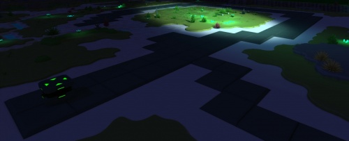
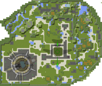
ZoneFar is a considerable modification of zoneOne. It retains the northernmost, western and southernmost features, but has its entire center and western areas reworked. Unlike its sister variant, Cornered, zoneFar has two large ponds that serve as hiding places: one to the west of the Drop Zone, and one almost directly along the path to the Feed Box. Surrounding the Feed Box though, is a complete absence of cover.
cornered
- Map creator: Daniel Dez
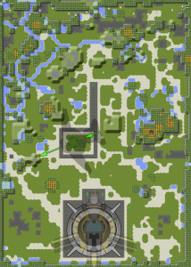
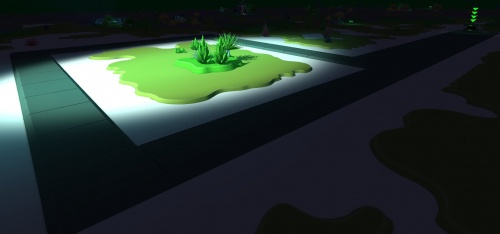
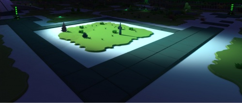
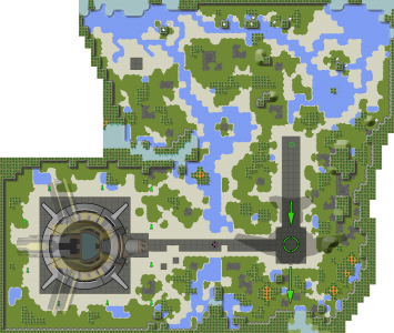
Cornered is a minor modification of zoneFar. The shortest travel path from the Drop Zone to the Feed Box, however, now runs behind the hill at the center of the map, giving Bunnies an opportunity to drop their collar and hide, or to conceal corpses here. Directly east of the Feed Box is also a large amount of terrain, and the Drop Zone is closer to the hilly region surrounding its west, making this map debatably easier for Bunnies to escape compared to zoneFar.
doublel
- Map creator: Daniel Dez
Double L has two Feed Boxes, one is dangerously close to the Robosaru's entrance, and the other is far from Robosaru. The player in Robosaru must decide whether they allow Bunnies to place items in the closest Box, risking Bunnies making a quick and easy subversion should the Robosaru player look away, or let Bunnies travel to the far Box, making it easy for them to successfully deter from the path into cover.
All the Bunny spawns are in a cluster on the far corner of the map.
airstrip
- Map creator: HexZyle
Airstrip is a map with very little hard cover and elevation. However, much of the map's surface is covered in water. The bunnies spawn near a very heavily watered area in the north and make their way southwest towards Robosaru, which only has a frontal approach. The direct approach is along a river, which forms a choke point due to the scarce plantation around it. The longer approach around the east and south side of the map has substantially more cover, but is considerably more time consuming to traverse. The Drop Zone and Feed Box are quite a distance from Robosaru.
ozone
- Map creator: kevinken
ozone has a wide, impassable cliff in the centre of the map, forcing subverting bunnies to either take the frontal, direct path in the South, or to take the back route at the North side of the map, accessible via a large area of water near the Feed Box.
The cliff that runs along the Drop Zone and near the Feed Box cannot be climbed onto, and thus can very easily be used to permanently stash items the Bunnies do not wish to deliver.
ozone was originally created under the name "zoneZero"
